Stockpile Volume Calculations
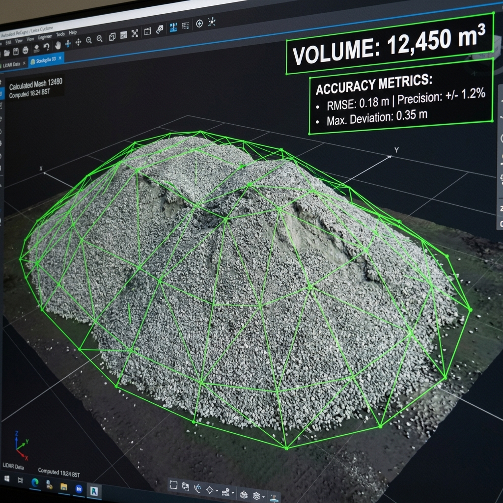
Replace costly manned surveys with aerial photogrammetry — delivering certified stockpile volumes to ±1.5% accuracy within 24 hours of flight.
Faster and more accurate than walking the pile
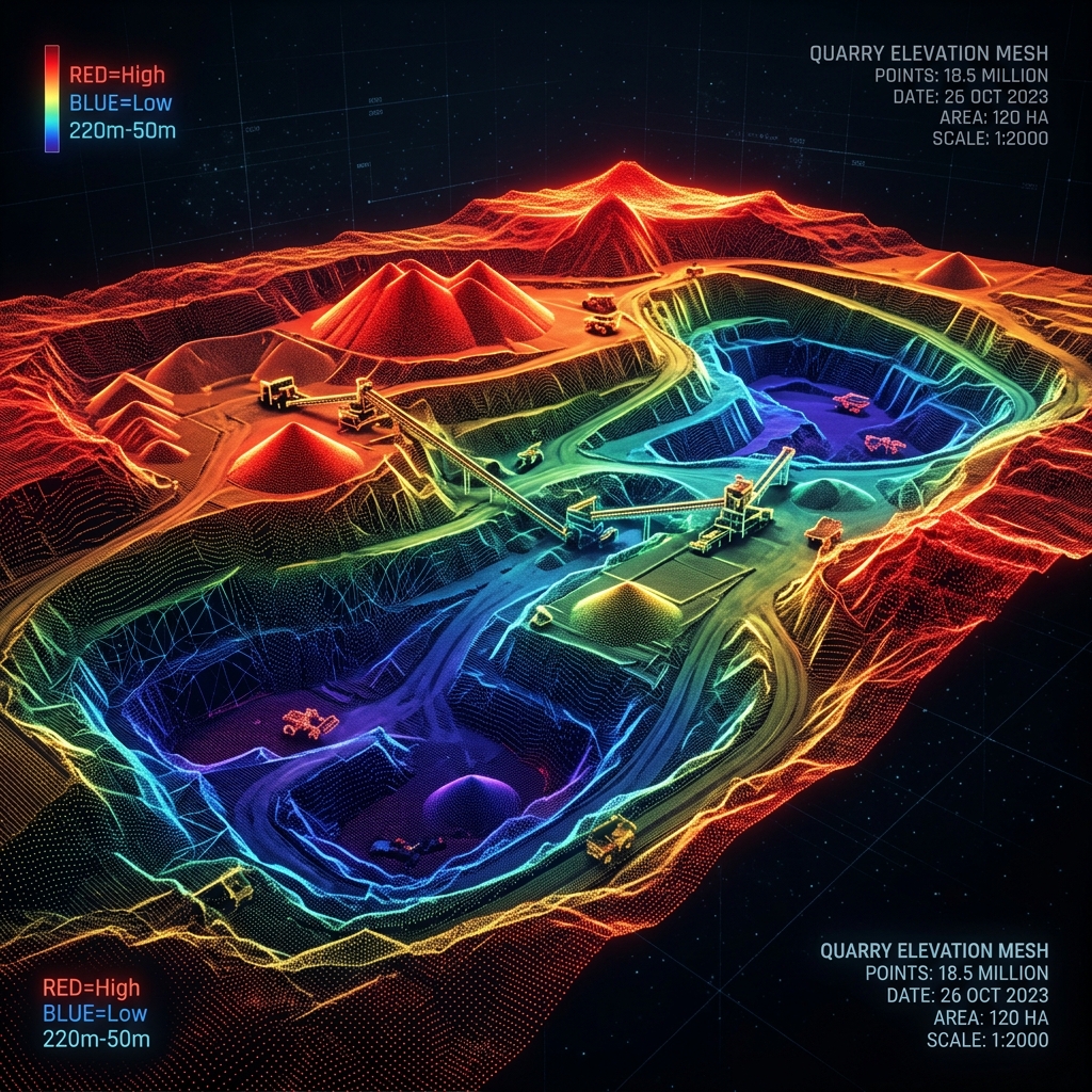
Traditional stockpile measurement requires a surveyor to physically walk every pile with a rod — time-consuming, inconsistent, and potentially hazardous on active aggregate or coal operations. Our drone photogrammetry captures the entire yard in a single flight, generating a dense point cloud from which volumes are calculated using industry-standard base-plane methodology.
Delivered as a PDF report + raw data package compatible with Stockpile Reports, DroneDeploy, and Pix4D workflows. Month-over-month trend charts available on recurring contracts.
Start measuring your piles accurately
Monthly contracts available statewide. Volume reports typically delivered within 24 hours of flight.
Request Volumetric Survey →