Prudhoe Bay Drone Operations.
Providing drone methane leak sniffer runs along oil gathering pipelines, mapping gravel pad volumetric stockpile reserves, and scanning heavy industrial machinery with thermal cameras.
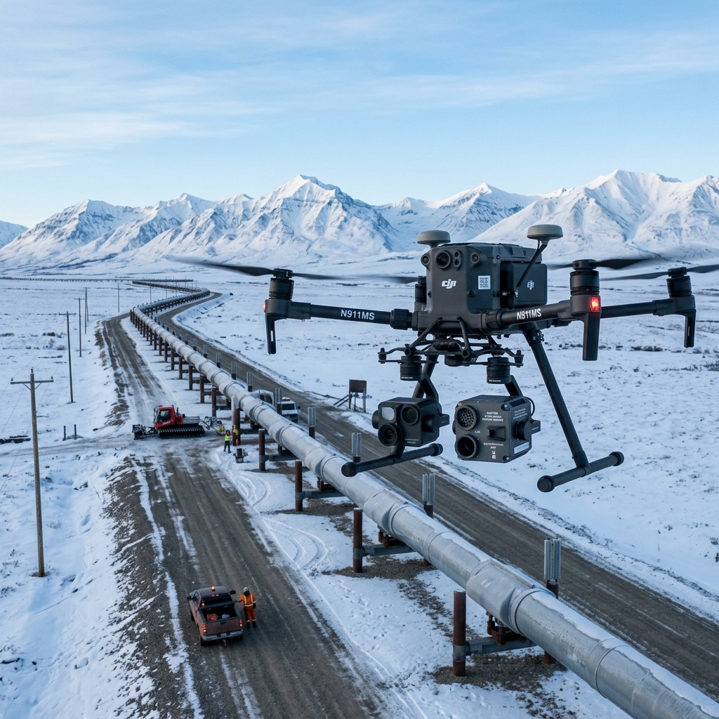 AERIAL VIEW // PRUDHOE BAY
 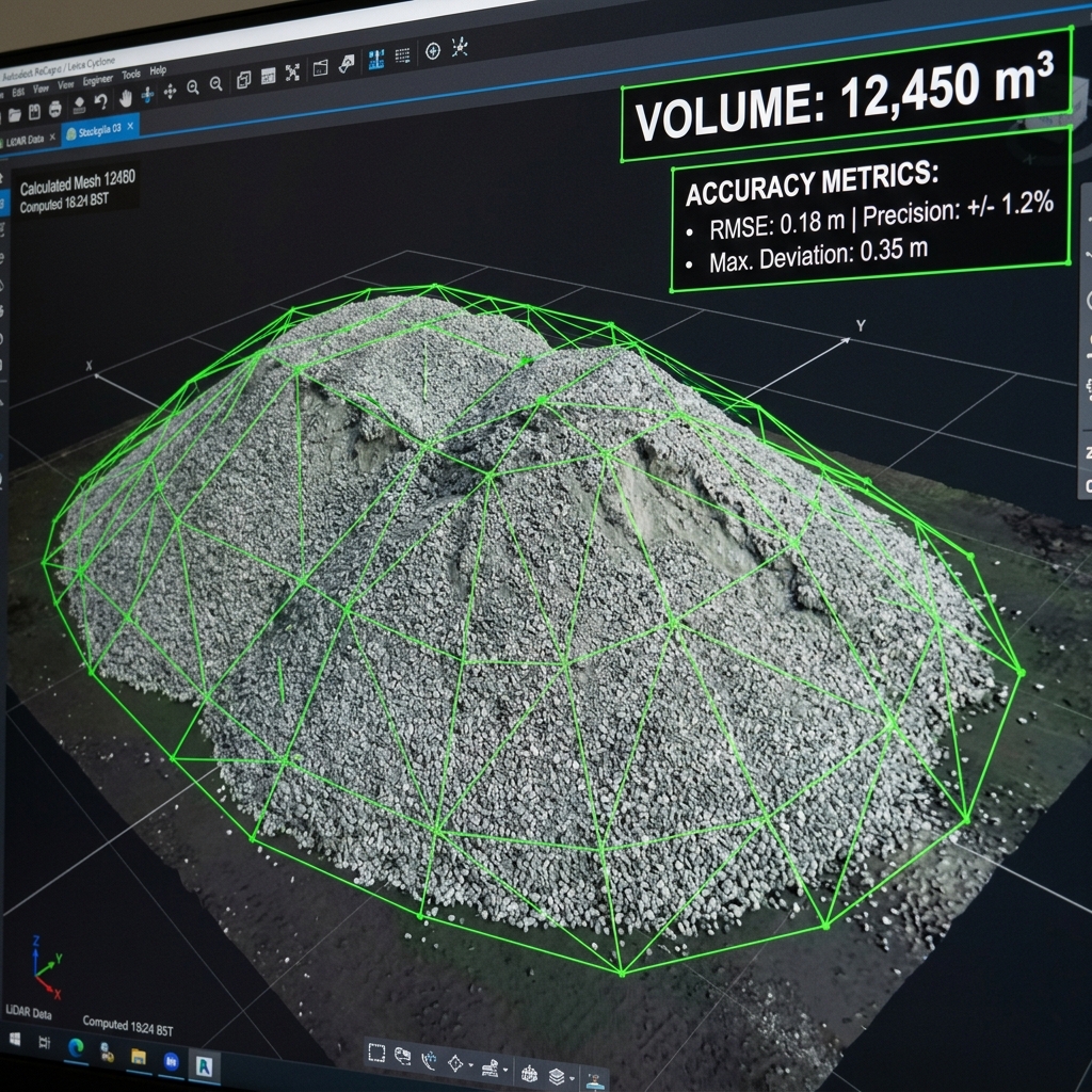 DATA DELIVERABLE // PRUDHOE BAY
 Location Data
Top Industries Served
- Oil & Gas
- Industrial Volumetrics
- Thermal Monitoring
Core Deliverables
- Orthomosaic Maps (3cm/px)
- LiDAR Terrain Profiles & DTMs
- Thermal Radiometric Scans
- 3D Point Clouds & Meshes
- 4K–8K Cinematic Media
- PDF Inspection Reports
- GIS / CAD-Ready Exports
Local Context
Why Prudhoe Bay missions require specialized expertise.
Operating commercial UAS in Prudhoe Bay and the broader Western & Arctic region demands experience with local weather patterns, terrain challenges, and regulatory nuances specific to Alaska's Class B/C/D airspace sectors. Our pilots have flown hundreds of missions in conditions that ground standard commercial operators.
Every Prudhoe Bay project begins with a custom site survey that accounts for local magnetic declination, wind corridor timing from mountain passes, and coordination with ATC when operating near controlled fields. This is not extra — it's standard for us.
Prudhoe Bay FAQ
01 What is your mobilization procedure for the North Slope?
+
What is your mobilization procedure for the North Slope?
We fly crews and specialized gear via shared slope flights, coordinating directly with field safety officers.
02 What is your turnaround time for deliverables?
+
What is your turnaround time for deliverables?
Standard deliverables (imagery, orthomosaics, inspection reports) are ready within 5 business days of flight. Rush 48-hour delivery is available for an additional fee.
Also Serving Nearby
Need a flight booked in Prudhoe Bay?
We specialize in complex, high-precision payloads and remote-site deployments across Western & Arctic Alaska.
COORD: 70.2553° N, 148.5139° W · FAA PART 107 COMPLIANT