North Pole Drone Operations.
Delivering compliant drone utility surveys, commercial roof condition assessments, and topographic models for flood control structures around Chena Lakes. We support Fairbanks-area contractors with weekly construction tracking across the Badger-Moose Creek development corridor.
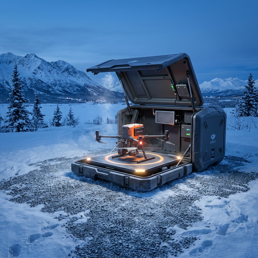 AERIAL VIEW // NORTH POLE
 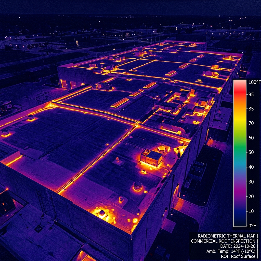 DATA DELIVERABLE // NORTH POLE
 Location Data
Top Industries Served
- Utility Surveys
- Commercial Roofing
- Flood Control
- Construction
Core Deliverables
- Orthomosaic Maps (3cm/px)
- LiDAR Terrain Profiles & DTMs
- Thermal Radiometric Scans
- 3D Point Clouds & Meshes
- 4K–8K Cinematic Media
- PDF Inspection Reports
- GIS / CAD-Ready Exports
Local Context
Why North Pole missions require specialized expertise.
Operating commercial UAS in North Pole and the broader Interior region demands experience with local weather patterns, terrain challenges, and regulatory nuances specific to Alaska's Class B/C/D airspace sectors. Our pilots have flown hundreds of missions in conditions that ground standard commercial operators.
Every North Pole project begins with a custom site survey that accounts for local magnetic declination, wind corridor timing from mountain passes, and coordination with ATC when operating near controlled fields. This is not extra — it's standard for us.
North Pole FAQ
01 Do you serve North Pole and the surrounding area?
+
Do you serve North Pole and the surrounding area?
Yes. We operate out of Fairbanks and cover all of the Tanana Flats communities with same-day dispatch capability.
02 What is your turnaround time for deliverables?
+
What is your turnaround time for deliverables?
Standard deliverables (imagery, orthomosaics, inspection reports) are ready within 5 business days of flight. Rush 48-hour delivery is available for an additional fee.
Also Serving Nearby
Need a flight booked in North Pole?
We specialize in complex, high-precision payloads and remote-site deployments across Interior Alaska.
COORD: 64.7511° N, 147.3519° W · FAA PART 107 COMPLIANT