Girdwood Drone Operations.
Capturing high-resolution mountain contour data, structural roof inspections for ski lodges and condos, avalanches path mapping, and high-end tourism marketing media for the Alyeska resort region.
 AERIAL VIEW // GIRDWOOD
 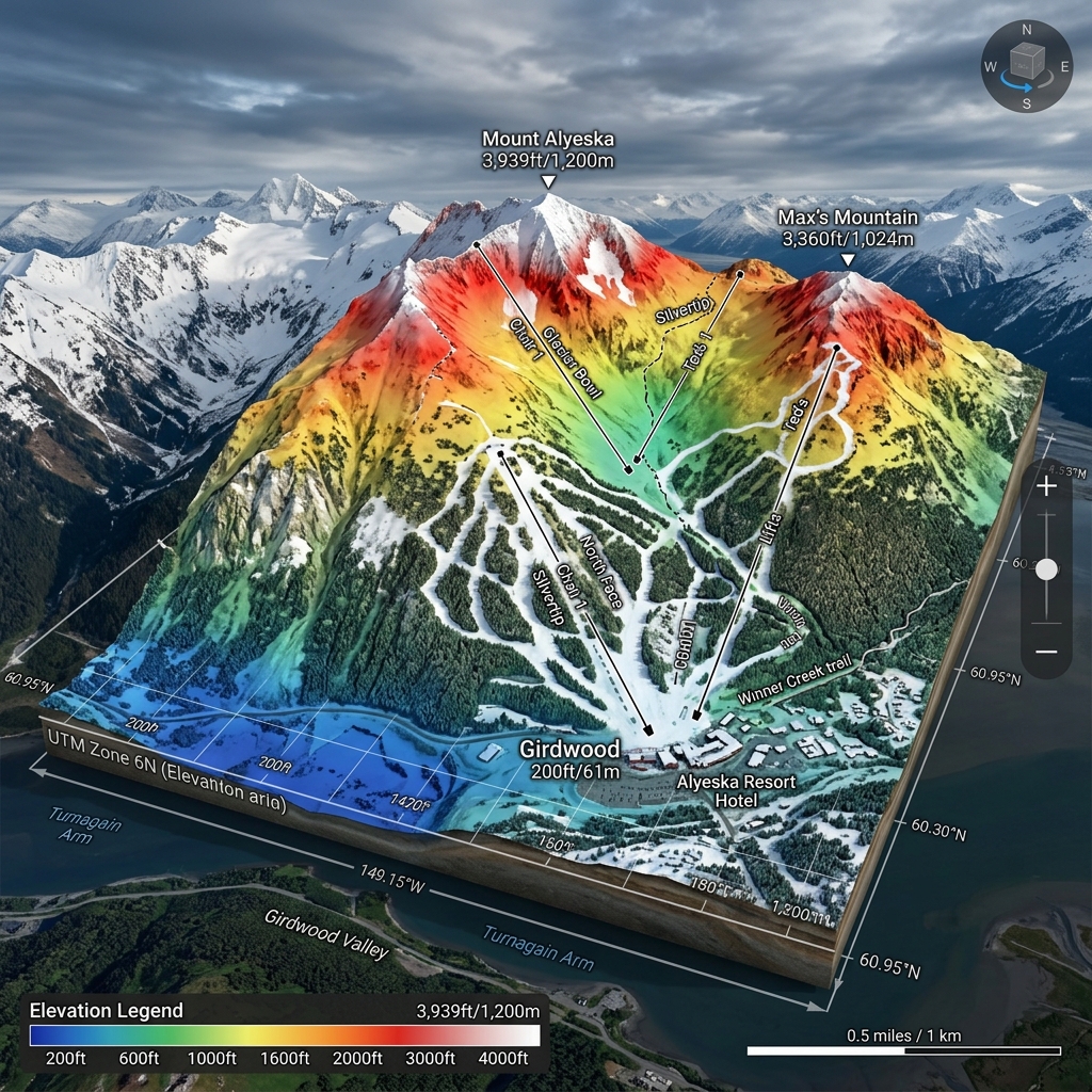 DATA DELIVERABLE // GIRDWOOD
 Location Data
Top Industries Served
- Tourism & Hospitality
- Real Estate
- Wildfire & Slope Safety
Core Deliverables
- Orthomosaic Maps (3cm/px)
- LiDAR Terrain Profiles & DTMs
- Thermal Radiometric Scans
- 3D Point Clouds & Meshes
- 4K–8K Cinematic Media
- PDF Inspection Reports
- GIS / CAD-Ready Exports
Local Context
Why Girdwood missions require specialized expertise.
Operating commercial UAS in Girdwood and the broader Southcentral region demands experience with local weather patterns, terrain challenges, and regulatory nuances specific to Alaska's Class B/C/D airspace sectors. Our pilots have flown hundreds of missions in conditions that ground standard commercial operators.
Every Girdwood project begins with a custom site survey that accounts for local magnetic declination, wind corridor timing from mountain passes, and coordination with ATC when operating near controlled fields. This is not extra — it's standard for us.
Girdwood FAQ
01 Do you fly in heavy winter snowfall?
+
Do you fly in heavy winter snowfall?
We fly in moderate snow if visibility permits, utilizing weather-sealed aircraft and heated batteries.
02 What is your turnaround time for deliverables?
+
What is your turnaround time for deliverables?
Standard deliverables (imagery, orthomosaics, inspection reports) are ready within 5 business days of flight. Rush 48-hour delivery is available for an additional fee.
Also Serving Nearby
Need a flight booked in Girdwood?
We specialize in complex, high-precision payloads and remote-site deployments across Southcentral Alaska.
COORD: 60.9575° N, 149.1628° W · FAA PART 107 COMPLIANT